Norwich City Centre to Earlham Cemetery (and back)
I decided last week to make an effort to walk to some of the places in Norwich which I haven’t managed to go to, or haven’t realised existed until recently. I called them micro-adventures, although they’re not overnight ones. I’ll be glad when Nathan and I can get going on the next GeoGuessr challenge (where we select a random location using GeoGuessr and just go there on public transport and see what happens), I liked those 🙂
Anyway, I was more on the lookout for things that I’ve never noticed before, so this walk was a little random. But there we go….
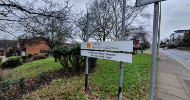
I’ve walked by this sign in the Cathedral Close many times before and never noticed this plaque noting where the Cathedral Bell Tower used to be. Unfortunately, the tower was taken down in the late sixteenth century, otherwise it could have made for quite the sight for those entering the Close.
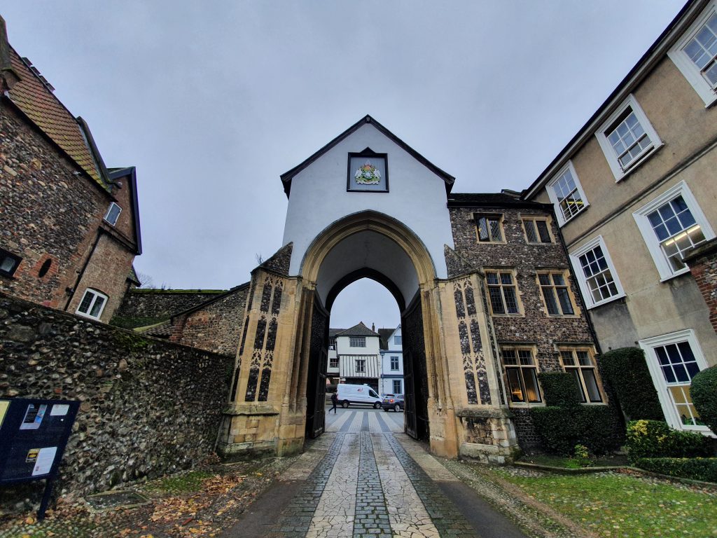
At the moment, due to the latest reconstruction of Tombland (which seems to partly involve changing the last reconstruction from a couple of years ago), the Erpingham Gate in the above photo is temporarily taking all the traffic into the Close whilst the Ethelbert Gate is closed.
This cut-through between Tombland and Princes Street shows the slightly wonky nature of the buildings here. I’ve walked this many times, I just like it….
A plaque for the Maddermarket Theatre that I’ve never noticed before. As the sign notes, the theatre’s building started off as a Roman Catholic Chapel at the end of the eighteenth century, before becoming a theatre in the early twentieth century.
And a sign noting where William Kemp morris danced his way to Norwich, apparently jumping over the wall of St. John the Baptist church to finish his adventure in 1600.
The cut through underneath the church tower of St. John the Baptist Church.
Another one of the city’s interesting markers showing where pubs once stood, in this case, the Farriers Arms between 1830 and 1895.
In this case, the pub is actually still there, now trading as the Belgian Monk.
A mural on the back of a wall on what I think might be the rear of Guildhall Tesco Metro, depicting the Castle, Cathedral and City Tower, part of the ‘City of Stories’ tagline.
And another new one on me, this plaque is located on Dove Street and notes that it’s where Anthony de Solempne set up his printing business when he moved to Norwich from the Netherlands. It was de Solempne who printed the first book in Norwich, Belijdenisse Ende, a book in Dutch meaning ‘a Confession of Faith’.
The Roman Catholic Cathedral in Norwich was designed by George Gilbert Scott, also called St. John the Baptist, with this one being the second largest Catholic Cathedral in the country. Last time I went here it was on a guided tour on the Heritage Day Open Weekend and the guide fell down the stairs. Which wasn’t ideal.
I think I had known this but forgotten, but the Cathedral was built on the site of the City of Norwich Gaol, open between 1827 and 1881.
The prison isn’t on many maps I usually use, but it is visible on this mid-nineteenth century tithe map.
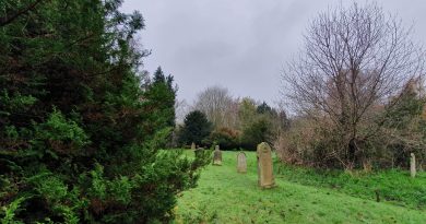
I’ll write more about Earlham Cemetery in separate posts, but this is the war graves area. There was a friendly lady who was clearing weeds and tending the graves who noticed I was intrigued by the Polish graves and she pointed out where the German ones were. I only noticed later that there was a Commonwealth War Graves Commission van nearby, she seemed a very good representative of this enormously worthwhile organisation.
A lot of the cemetery feels quite remote, but it’s well tended and cared for.
One of the more impressive tombs. I went to look at the Jewish section of the graveyard and managed to get a little lost in the crematorium gardens, which were rather peaceful with the water fountain and quiet feel. I didn’t want to trample over their grass, so went back the way I came and managed to only just avoid a funeral procession.
This is the site of the historic Earl of Leicester pub which the city council gave approval to demolish in 2005. What a marvellous idea that was, here it is in 2020 (the big green bit with nothing on it, not the houses behind it). I’m slightly surprised that the city council hasn’t tried to build a car park on the site.
Unfortunately, Brasov Restaurant has now been closed and the building is being refurbished into something new.
And this is the former JD Wetherspoon’s City Gate, which closed about ten years ago.
The new student accommodation building that has been built on what was the car park to Toys ‘R Us. It’s in my opinion a depressing looking building, devoid of interest and entirely ignoring the city wall in front of it. Alumno Group, who designed the building, must have been delighted when this got approved by Norwich City Council. Anyway, I’m sure that it’s lovely inside.
I’ve never gone to investigate St. Benedict’s Church Tower and it’s hard to imagine that this is the same church as appeared in George Plunkett’s photo from 1934.
Hales Court, which isn’t a path that I’ve seen before. Today it connects Cleveland Road with Chapel Field North, but the former road is relatively new, this was previously just all housing.
Excuse my lack of graphical skills, but the green line is the old route of Hales Court and I took the photo from where that small red blob is. As may be evident, I’ve marked this map up myself and didn’t get professional help.
And this is where Hales Court meets Chapel Field North.
Cow Yard, which has now been rebuilt behind that gate following the demolition of some older residential properties. George Plunkett has a photo of this from 1936.
Something else that I’ve never noticed before, a plaque to the artist Henry Ninham who lived here.
And here’s the house that Ninham lived in.
An old stone sign embedded into the wall at Ninhams Court.
Now renamed after the artist, this was formerly known as Master’s Court.
And that put me back into Norwich city centre, having managed to see numerous pieces of history that I’ve paid no attention to before. It reaffirms my theory that there are always new things out there to discover, even in familiar areas, even if they are a little niche. The walk was about 5.5 miles and I spent a little longer in the cemetery than I had anticipated, but more on that in later posts…


