King’s Lynn – Former A47 Road Bridge
Walking along the quieter of the two road bridges across the River Great Ouse (the other is visible in the background of the above photos), I wondered what the supports next to it once held up. I assumed it must be the rail bridge that I knew went near here, although that didn’t make sense as there were no signs of a former railway line at either end.
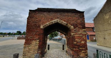
Two of the bridge supports.
This is the support on the north side of the river.
And, the answer is here (click on the image to see a clearer one). There are two bridges in the same place on the two maps, the first map is from the 1950s and the second map is a current one. On the first map, the top bridge is the A47 road and the lower bridge is the rail bridge. On the second map, the top bridge is now Wisbech Road bridge and the lower bridge is the A47 road. Confusing…. But, that’s why the remnants of the bridge are there, it was another carriageway of the A47, which was taken down when a new road was constructed when the rail bridge was taken down following the closure of the rail line in 1959. The route of the A47 was then changed to follow much of the former rail line, leaving the bridges as they are now.


