London – British Museum (1500s Map of Nordovicum)
I usually visit the British Museum three or four times a year, something which is a little difficult to do with the current virus situation, primarily because it’s shut. However, they’ve placed hundreds of thousands of images on their web-site, so this will have to do me for the moment. The images can be used non-commercially, as long as the British Museum is credited. So, this is their credit.
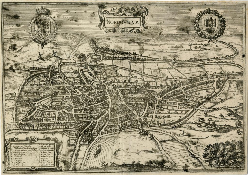
Clicking on the above image will bring up a larger version. It’s one of the better known plans of Norwich (or Nordovicum), issued at some point after 1581. It’s been in the British Museum collections for so long they don’t know when they got it, but it was before 1811.
Anyway, it’s gorgeous. At the top is Bishopgate Bridge, when it still had its gate, and Cow Tower is visible to the left of that. To the bottom, at number 14, is “Hell Gates”, which is more usually called Heigham Gate, but I prefer the version on this plan of the city. And near number 17, which is St. Stephen’s Gate, is near where the St. Stephen’s outlet of Greggs is now located.

