Matthew Paris’s Clickable Map
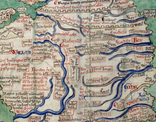
This is a useful web-site, it’s an annotated version of Matthew Paris’s map of Britain, from around 1250. It’s not a bad stab at the geography of the country, with Paris being a monk who worked from St. Alban’s Abbey in Hertfordshire.
Visitors to the site can hover over any old place name or description. The details for Wales are quite long, noting the region as:
“A marshy, woody, hilly, and impassible region, suitable for shepherds. The inhabitants are agile, barbaric, and warlike”.


