Moulton – Packhorse Bridge
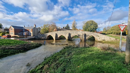
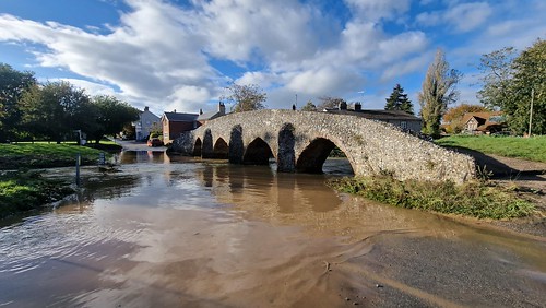
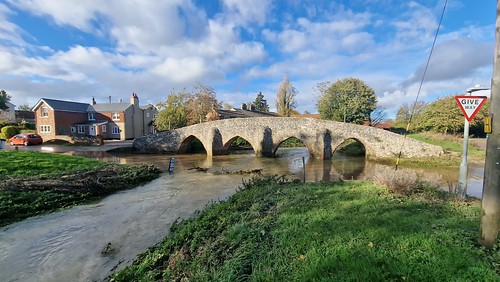
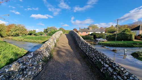
Obviously my favourite bridge is the new one at Great Yarmouth that my friend Liam is building (or whatever he’s doing there), but this comes a close second. It’s the rather beautiful Grade II* listed packhorse bridge at Moulton, near Newmarket in Suffolk. I’ll quote what Wikipedia note in terms of the definition of packhorse bridges:
“A packhorse bridge is a bridge intended to carry packhorses (horses loaded with sidebags or panniers) across a river or stream. Typically a packhorse bridge consists of one or more narrow (one horse wide) masonry arches, and has low parapets so as not to interfere with the panniers borne by the horses.”
Being unsure exactly what classed as a packhorse bridge, I consulted the book ‘A Guide to the Packhorse Bridges of England’ by Ernest Hinchliffe and he didn’t disappoint. He wrote:
“Of first importance is width. Before the eighteenth century, bridges were described either as horse bridges or cart bridges and the dimensions and manoeuvrability of carts must have been important in distinguishing the one from the other. Making allowance for a wobbly vehicle drawn by an erratic animal on a rough surface, it is unlikely that a cart bridge would be less than six feet wide. Age too is important. The packhorse transport system was slowly killed by the canals and by wheeled traffic on turnpike roads and since the Turnpike Act was passed in 1663 and the last Turnpike Act disappeared in 1895, it was a lingering death.”
The author is happy with Moulton’s bridge passing muster and he notes that it is often the one used in photographs of packhorse bridges. Although I’d add to the note that English Heritage think it might not be a packhorse bridge as it could take carts, but my expertise on this matter means I’m happy to settle with Hinchliffe’s description.
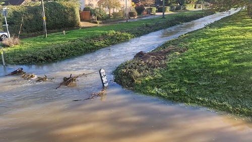
I would add that the water isn’t normally this deep, but heavy rain in the area caused some flooding along the River Kennett when Bev and I popped to have a little look at it. I’d add that Bev managed to find a fish that had managed to get caught up in a puddle, so her good deed for the day was throwing it back into the river. Anyway, I digress.
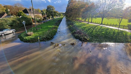
The view from the bridge, there’s a ‘Danger – Deep Water’ sign there to stop anyone from driving down the river.
The water was nearly two foot deep, although a couple of large vehicles did plough through across the ford whilst we were there. It felt a bit like watching something from Rufford Ford which became something of a minor TikTok sensation for a short while.
Given how high the river was, a bridge here was most helpful for our purpose of visiting the village’s church. The stone bridge dates to around the fourteenth or fifteenth century and it was part of a packhorse route between Bury St Edmunds and Cambridge. Hinchliffe, in his packhorse book, notes though that “the notice alongside the bridge quotes an early fifteenth century date, but since Moulton was a market town at the end of the thirteenth century, it is possible that there was a bridge on the site to serve local market traffic before the current structure”. There was a similar bridge in nearby Kentford, but more of that in another post.
Historically, the bridge was financed by the Church and Bridges Estate which had been established in the early sixteenth century. Although they must have done a decent job for some centuries given that it’s still there, the West Suffolk county planning committee met in June 1962 to authorise expenditure of between £45 and £50 to repair the bridge. At the same time, they asked the Ministry of Works to take over the cost of repairing the bridge from the church charity.
The Newmarket Journal reported in March 1961 that the bridge had been scheduled as an ancient monument by the Ministry of Works, with the newspaper noting that “it is one of the best known ancient bridges in the county”. Today, it’s certainly something special and it’s remarkable that this has survived in its medieval form.

