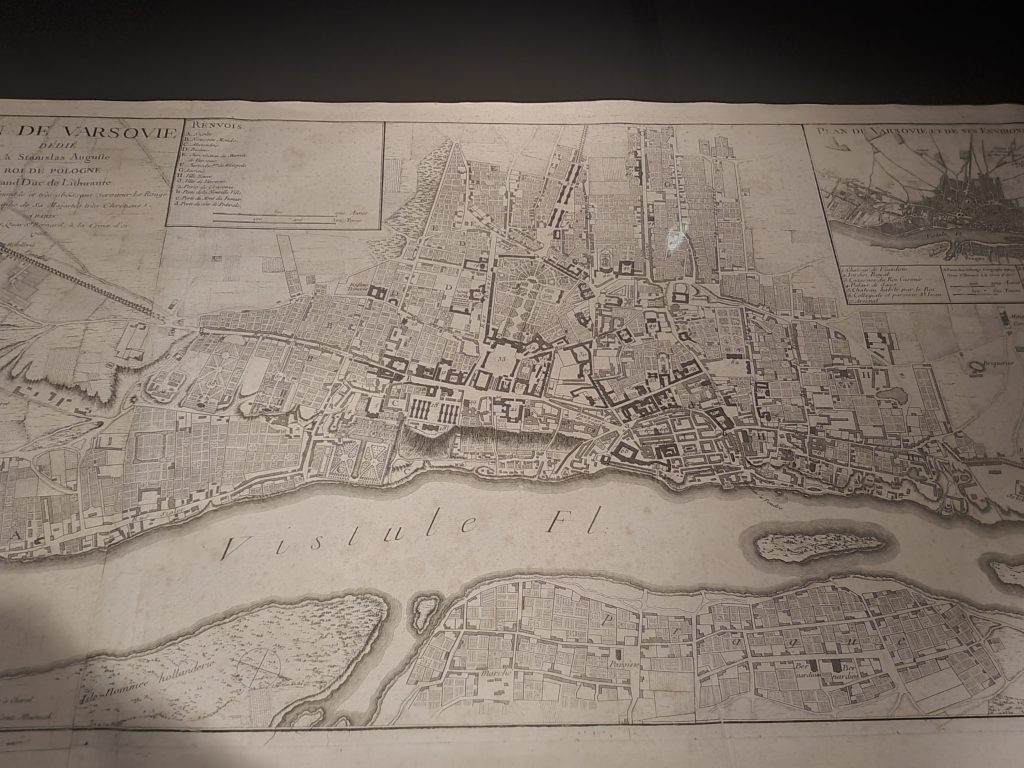
Warsaw – Museum of Warsaw (Early Map of Warsaw)
I’ve decided that I take too many photos, as is apparent when I’m working through my galleries after a visit anywhere, including Poland where I returned back from two weeks ago. But, I doubt I’ll change that little flaw in my character, so I’ll have to just manage the large amount of data I create…..
Anyway, this is one of the many maps which is available in the Maps Room of the Museum of Warsaw. It’s possible to make the map larger by clicking on the image above, which makes it very evident just how much Warsaw has changed. Although it’s possible to make out the Old Town area and a few of the larger streets, so much of the city has changed that it is quite a challenge to tie everything in (or at least, it was for me). I spent quite a while just gazing at this map, fascinated by just how much Warsaw has evolved over the last two centuries, albeit much of it forced because other countries kept damaging it.


